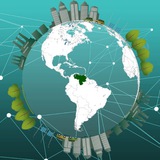
Un poquito de Software Privativo: Concurse con sus trabajos #SIG usando #ArcGIS en la Conferencia Web Esri Venezuela 2017 http://bit.ly/2urnzcI … http://ift.tt/2u15mBd
Fuente: http://www.esriven.com/events/uncategorized/conferencia-web-esri-2017-2/?utm_content=buffer20871&utm_medium=social&utm_source=twitter.com&utm_campaign=buffer
Fuente: http://www.esriven.com/events/uncategorized/conferencia-web-esri-2017-2/?utm_content=buffer20871&utm_medium=social&utm_source=twitter.com&utm_campaign=buffer
Instagram
Esri Venezuela
Concurse con sus trabajos #SIG usando #ArcGIS en la Conferencia Web Esri Venezuela 2017 https://t.co/7uN8wgjy5G https://t.co/qbSNT2hs6o
Curvas de nivel 💯🎯
.
.
.
.
#curvasdenivel #earth #geodesy #geologists #topology #satellite #planets #earth #map #cosmos #maps #ecology #projectionmapping #topography #mapas #geology #drone #geographic #geografia #geografía #arcgis #cartografia #agrimensura #cartography #gis #qgis #satelliteimagery #geograph #geospatial #cartography
https://www.instagram.com/p/CAu4SzqjgRq/?igshid=bym1zxl056sk
.
.
.
.
#curvasdenivel #earth #geodesy #geologists #topology #satellite #planets #earth #map #cosmos #maps #ecology #projectionmapping #topography #mapas #geology #drone #geographic #geografia #geografía #arcgis #cartografia #agrimensura #cartography #gis #qgis #satelliteimagery #geograph #geospatial #cartography
https://www.instagram.com/p/CAu4SzqjgRq/?igshid=bym1zxl056sk
18 FREE RASTER DATA SOURCES
1. USGS Earth Explorer
➡️ Data Types: Landsat, Sentinel, ASTER, MODIS, and other remote sensing imagery.
➡️ Website: https://lnkd.in/dhfrySmj
2. Copernicus Open Access Hub
➡️ Data Types: Sentinel-1, Sentinel-2, Sentinel-3, and other Copernicus datasets.
➡️ Website: https://lnkd.in/dhKKDmVT
3. NASA Earthdata
➡️ Data Types: MODIS, VIIRS, SMAP, and other NASA satellite products.
➡️ Website: https://lnkd.in/dBjqvkmA
4. ESA Earth Online
➡️ Data Types: Envisat, ERS, Sentinel, and other ESA missions.
➡️ Website: https://earth.esa.int/
5. NOAA Digital Coast
➡️ Data Types: Coastal imagery, elevation, and land cover.
➡️ Website: https://lnkd.in/dSRG6r-Z
6. OpenTopography
➡️ Data Types: High-resolution topographic data, including LiDAR-derived raster data.
➡️ Website: https://lnkd.in/dk-bZ_79
7. Global Land Cover Facility (GLCF)
➡️ Data Types: Land cover and vegetation datasets.
➡️ Website: https://lnkd.in/dgTYMDG7
8. Natural Earth Data
➡️ Data Types: Raster data for relief and shaded relief imagery.
➡️ Website: https://lnkd.in/dwzxTY5Q
9. Geospatial Data Abstraction Library (GDAL) Links
➡️ Data Types: Provides links to raster datasets from various organizations.
➡️ Website: https://gdal.org/
10. Earth Observation Explorer (EOx)
➡️ Data Types: Multispectral and terrain data from Sentinel and Landsat.
➡️ Website:https://lnkd.in/dkBHERk8
11. Google Earth Engine (GEE)
➡️ Data Types: Vast catalog of geospatial datasets, including satellite imagery and climate data.
➡️ Website: https://lnkd.in/dVun-hzp
12. DigitalGlobe/Maxar Open Data Program
➡️ Data Types: High-resolution satellite imagery for disaster response.
➡️ Website: https://lnkd.in/dSneef8b
13. WorldClim
➡️ Data Types: Climate raster data such as temperature and precipitation.
➡️ Website: https://www.worldclim.org/
14. OpenAerialMap
➡️ Data Types: Aerial imagery collected by individuals and organizations.
➡️ Website: https://openaerialmap.org/
15. Global Forest Watch
➡️ Data Types: Forest change, loss, and gain raster data.
➡️ Website: https://lnkd.in/d7iSVF3C
16. UNEP Environmental Data Explorer
➡️ Data Types: Environmental raster data like climate, emissions, and ecosystems.
➡️ Website: https://lnkd.in/ddjKwkuf
17. Terraclimate
➡️ Data Types: Monthly climate and hydrology data at a global scale.
➡️ Website: https://lnkd.in/dTAE4NMi
18. Global Historical Climatology Network (GHCN)
➡️ Data Types: Raster-based climate and weather datasets.
➡️ Website: https://lnkd.in/d5g8mixn
If you find this post valuable, kindly consider reposting.
Background Image: Satellite Imaging Corporation
hashtag#GIS hashtag#RemoteSensing hashtag#Geospatial hashtag#Sentinel hashtag#Landsat hashtag#USGS hashtag#ESA hashtag#GDAL hashtag#OpenTopography hashtag#NOAA hashtag#NASA hashtag#Copernicus hashtag#WorldClim hashtag#ClimateChange hashtag#Sustainability hashtag#QGIS hashtag#ArcGIS hashtag#ESRI
16 FREE SOURCES OF GIS VECTOR DATA
1. OpenStreetMap (OSM)
➡️ URL: openstreetmap.org
➡️ Data: Roads, buildings, land use, and more.
➡️ Format: Shapefile, GeoJSON, OSM XML.
2. Geofabrik
➡️ URL: download.geofabrik.de
➡️ Data: Extracts of OSM data by region.
➡️ Format: Shapefile, GeoJSON, PBF.
3. Humanitarian Data Exchange (HDX)
➡️ URL: data.humdata.org
➡️ Data: Humanitarian-related datasets, including population and infrastructure.
➡️ Format: Shapefile, GeoJSON, CSV.
4. HYDROSHEDS
➡️ URL: hydrosheds.org/products
➡️ Data: Rivers, Lakes, Basins, Waterfalls, etc.
➡️ Format: Shapefile
5. FAO GeoNetwork
➡️ URL: fao.org/geonetwork
➡️ Data: Agriculture, fisheries, and environmental data.
➡️ Format: Shapefile, GeoJSON.
6. USGS Earth Explorer
➡️ URL: earthexplorer.usgs.gov
➡️ Data: Hydrography, transportation, boundaries.
➡️ Format: Shapefile, KML.
7. Natural Earth
➡️ URL: naturalearthdata.com
➡️ Data: Political boundaries, cultural, and physical features.
➡️ Format: Shapefile, GeoJSON.
8. European Environment Agency (EEA)
➡️ URL: eea.europa.eu
➡️ Data: Environmental themes like land cover, air quality, and biodiversity.
➡️ Format: Shapefile, GeoJSON.
9. GADM (Global Administrative Areas)
➡️ URL: gadm.org
➡️ Data: Administrative boundaries at multiple levels.
➡️ Format: Shapefile, GeoJSON, KML.
10. DIVA-GIS
➡️ URL: diva-gis.org
➡️ Data: Country-level data on climate, population, and administrative boundaries.
11. UNEP Environmental Data Explorer
➡️ URL: uneplive.unep.org
➡️ Data: Environmental indicators and spatial datasets.
➡️ Format: Shapefile, GeoJSON.
12. NASA Socioeconomic Data and Applications Center (SEDAC)
➡️ URL: sedac.ciesin.columbia.edu
➡️ Data: Population, infrastructure, and environmental indicators.
➡️ Format: Shapefile, GeoJSON, KML.
13. World Resources Institute (WRI) Open Data Portal
➡️ URL: https://www.wri.org/data
➡️ Data: Environmental and natural resource datasets.
➡️ Format: Shapefile, GeoJSON, CSV.
14. Global Forest Watch
➡️ URL: globalforestwatch.org
➡️ Data: Forest cover, deforestation, and land use.
➡️ Format: Shapefile, GeoJSON, KML.
15. Africa GeoPortal
➡️ URL: africageoportal.com
➡️ Data: Administrative boundaries, land cover, and infrastructure across Africa.
➡️ Format: Shapefile, GeoJSON.
16. Koordinates
➡️ URL: koordinates.com
➡️ Data: Various themes including environmental, infrastructure, and social data.
➡️ Format: Shapefile, GeoJSON, KML.
If you find this post valuable, kindly consider reposting.
hashtag#GIS hashtag#Geospatial hashtag#FAO hashtag#PrecisionAgriculture hashtag#USGS hashtag#OpenStreetMap hashtag#OSM hashtag#Shapefile hashtag#GeoJSON hashtag#KML hashtag#CSV hashtag#Python hashtag#R hashtag#GoogleEarthEngine hashtag#QGIS hashtag#ArcGIS hashtag#DataViz hashtag#DataAnalytics hashtag#DataScience hashtag#UNEP hashtag#HDX